
Tracing a Mountain House Street
A reliable address search moves from the physical location to the county parcel record, then from the parcel to a named owner and a recorded instrument. The chain can add a voter clue or a historic directory entry, but each source has a narrower meaning. Address fields can identify a situs parcel. The assessor roll can show an owner and mailing address. A deed can show parties to a transaction. A reverse directory can show a listed household at one point in time. None is a complete list of everyone present on a street.
- Enter the street number and name in the county property lookup. Save the APN, situs address, record number, and unit information shown.
- Open the county GIS viewer and inspect the parcel shape, street line, districts, and nearby APNs. Repeat the parcel check for each address in a street segment.
- Use the Assessor route to compare the listed owner with the mailing and situs fields. Treat a mailing match as a clue, not proof of household occupancy.
- Search the Recorder index by the owner as grantee, read the acquisition instrument, and follow the grantor backward only when the legal description matches.
- For older households, consult the county directory and reverse-directory shelf at the Historical Museum, then compare the entry with census, obituary, or assessment evidence.
Mountain House Accela Fields
San Joaquin County's free Accela Look Up Property Information portal is the practical first stop for a modern address. JavaScript can error, so a failed screen is not proof that the parcel or permit is absent. The search menu separates Address, Parcel Information, Owner, Record Information, and Licensed Professional modes. Start with Address, then use the APN or record number in the more exact mode.
| Field label | Type | Required | Options or format notes |
|---|---|---|---|
| Search Type | Dropdown | Yes | Address, Parcel Information, Owner, Record Information, Licensed Professional |
| Street Number | Range text pair | No | Start and end values can browse a street segment |
| Direction | Dropdown | No | Use the displayed directional value when a street has one |
| Street Name | Text | No | Enter the base name before narrowing the result |
| Street Type | Dropdown | No | Select the road suffix when the address needs it |
| Unit Type | Dropdown | No | Refines an address with a unit designation |
| Unit No. | Text | No | Use the unit value when one is part of the situs |
| City | Text | No | Mountain House can refine the address result |
| State | Text | No | California can refine the address result |
| Zip | Text | No | 95391 can refine the Mountain House search |
| Look Up / Clear | Buttons | Neither | JavaScript is required for the form to return a result |
Use the street range sparingly. A broad range can return permits, applications, and licensed-professional records rather than a clean owner roll. The county counter remains the fallback when the form fails or a field does not expose the needed history.
Note: JavaScript can fail in Accela, so retain the street, APN, and record details needed for a counter request.
Mountain House Street Records
The Mountain House by-address record trail is strongest when a parcel key joins records that were created for different purposes. The Assessor answers an ownership and assessment question. GIS answers a boundary and jurisdiction question. The Recorder answers a title-party question. Planning files answer a project question. A voter file, when lawfully available, answers a controlled registration question. Keeping those meanings separate prevents a permit contact or tax mailing address from being presented as a resident.
| Record set | Keeper | Street-level evidence | Access |
|---|---|---|---|
| Assessment roll | San Joaquin County Assessor | Owner, APN, mailing and situs distinction, values and characteristics | Accela or county counter; protected fields may be redacted |
| Parcel map and GIS | San Joaquin County GIS | Parcels, streets, districts, zoning, annexations, and city limits | Free viewers and downloads; no property-tax data |
| Deed index and image | Recorder Division | Grantor, grantee, instrument, date, legal description, and APN reference | Online index from January 1, 1968; older counter records |
| Tax bill route | Treasurer-Tax Collector | Fee parcel, assessed charges, and tax status | Online or counter; owner and debtor can differ |
| Permit and project file | Mountain House Planning and legacy county CDD | Applicant, owner, contractor, project, dates, and status | City project pages, Accela, or focused CPRA request |
| Subdivision or parcel map | Recorder and Assessor | Tract, lot, block, easement, and parent-parcel geometry | Recorded maps; copies have published fees |
| Voter registration file | San Joaquin County Registrar of Voters | Address fields only through an approved access route | No casual street browse; written application and qualified purpose |
APN is the bridge. A street name can change, a new lot can split an agricultural parcel, and a mailing address can point outside the situs. Preserve the APN and legal description beside every name and date in the working notes.
Note: GIS confirms parcel geography, not tax data, so use the Assessor or Treasurer for ownership and bill questions.
Mountain House Street Parcels
The San Joaquin GIS map applications page leads to the District Viewer and other tools that place an address in its surrounding geography. Use the viewer to see parcel lines, streets, school and fire districts, water areas, planning layers, and other jurisdictional context before comparing nearby addresses.
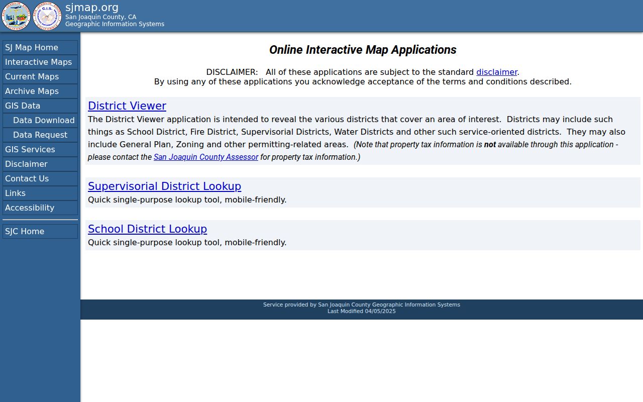
The applications view is useful for locating the right map layer, but it does not turn the map into a resident roster. Each neighboring parcel needs its own APN and a separate, lawful Assessor check.
The Assessment Map Viewer supplies the parcel-map key. Its APN convention uses a map book, page or block value, and parcel number. The first three APN digits point to the book, the next two identify the page, and the parcel is then located on the map. The owner record remains separate from the geometry.
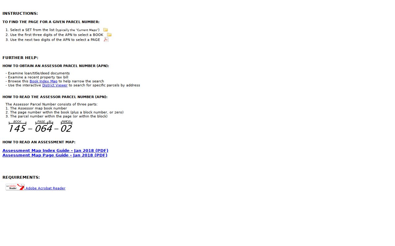
An assessment map can show how lots touch and how a tract was laid out. It cannot by itself establish who lives in any one structure.
A Mountain House Address Through Time
Mountain House was planned as a network of villages and a Town Center, not as an old municipal quadrant grid. Framework roads include Mountain House Parkway, Byron Road, Grant Line Road, Central Parkway, and Main Street. The neighborhood names organize development, but the durable historical key is the lot, tract, APN, and recorded legal description. A street search that relies only on its current name can miss the agricultural parent parcel that appears in older records.
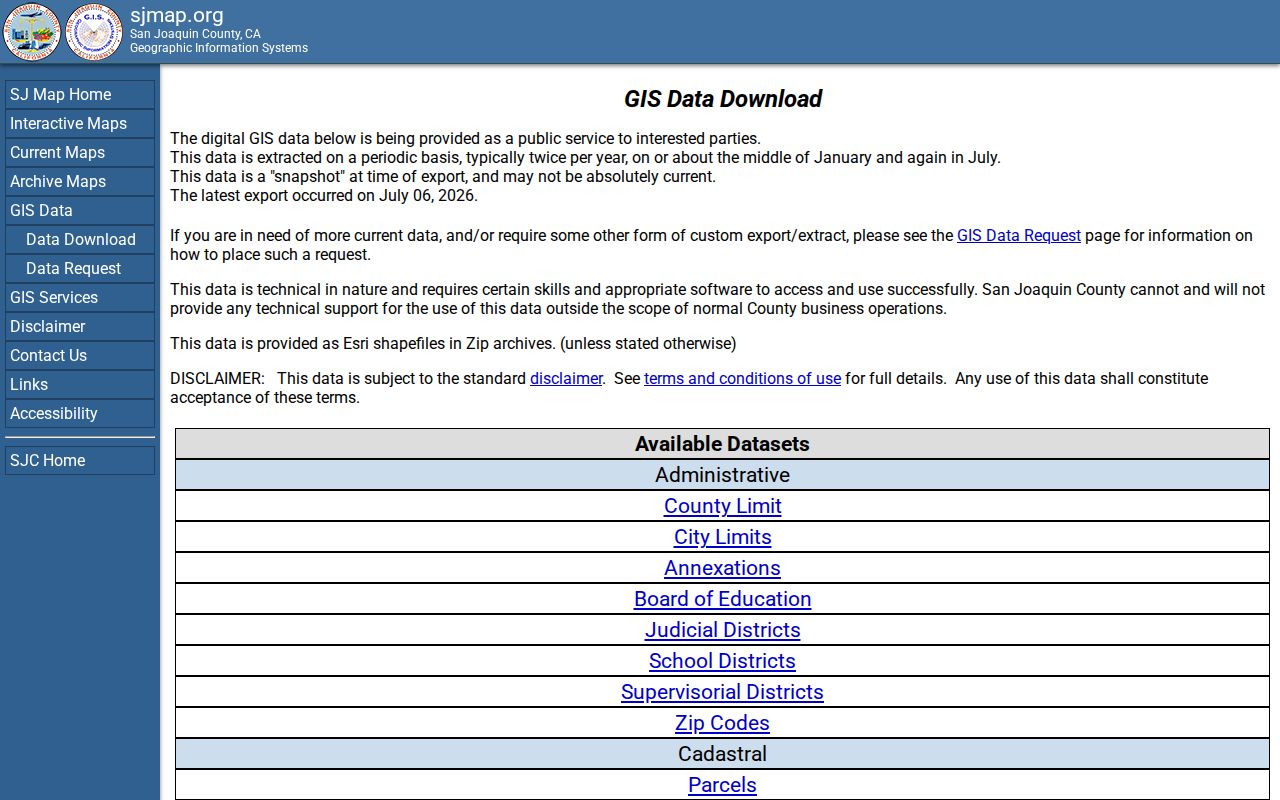
The San Joaquin GIS data downloads provide address grids, address-grid regions and sections, streets, parcels, ZIP codes, city limits, annexations, zoning, and district layers. They support a comparison between postal geography and legal city geography without pretending the two are identical.
No verified citywide renumbering year was found. The continuity issue is new development and parcel lineage, not a documented one-time renumbering. Voters approved incorporation on March 5, 2024, and cityhood took effect July 1, 2024. Older planning and administration records may sit with the Community Services District or county, while later planning, council, and business-license files move to Mountain House. The 95391 postal identity predates cityhood, so a record date helps route the request.
Note: A new Mountain House street may require a recorded map and parent APN before an older county record can be matched.
Mountain House Street Deed Trail
The Recorder is a name index, not a street-wide list. For an address trail, begin with the Assessor owner and APN, find that owner as grantee, and read the acquisition document for its grantor, recording date, instrument number, book or page, and legal description. Search the prior seller as an earlier grantee only after the parcel description matches. This method distinguishes a real chain from a same-name coincidence.
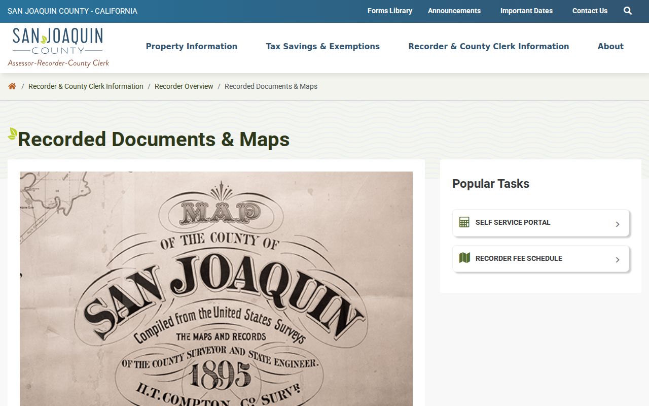
The Recorded Documents and Maps service identifies the county's public access route. The online grantor-grantee index begins January 1, 1968 and the office holds digital or film deeds and maps reaching back to 1851.
For a pre-1968 chain, use the Recorder counter at Suite 260, 44 N. San Joaquin Street, Stockton, California 95202, or call 209-468-3939. General weekday hours are 8:00 a.m. to 4:30 p.m.; recording hours are 8:00 a.m. to 4:00 p.m. Self-assisted copies are $1 per page, staff-assisted copies are $3 per page, certification is $2 per document, and maps are $5 plus $2 for certification.
Mountain House Permit and Tax Clues
Permit and project records add dates and construction context to an address search. Mountain House Planning publishes active project material with addresses, APNs, owners or applicants, lot counts, environmental documents, and hearing status. Older files may remain in county Community Development systems. An applicant, architect, licensed professional, or contractor is tied to a project record, not automatically to the household at the address.
The county's property-tax payment route is a separate source for a fee parcel, tax charge, or status question. It is not a substitute for the assessment roll or a deed, and a tax debtor may not be the current title owner.

The tax route reinforces a useful boundary: taxes, title, permits, and occupancy are different record questions. A focused California Public Records Act request can seek an existing, nonexempt city or county file when a document is not posted. Describe the address, APN, date range, department, and document type.
Mountain House Reverse Directory Shelf
Historical reverse or criss-cross directories can turn a street number into a listed occupant or business, but coverage depends on the publisher and the year. The San Joaquin County Historical Museum holds county city and directory runs from 1852 through 1980, along with assessment and plat books, Great Registers, maps, aerial photographs, and other county archives. Future Mountain House land may appear under a rural route, farm, township, or parent locality rather than the modern city name.
Archive access is appointment only at the Historical Museum in the Erickson Building at Micke Grove Regional Park, 11793 N. Micke Grove Road, Lodi. Call 209-331-2055 before planning research; published public hours are Thursday through Sunday, 10:00 a.m. to 4:00 p.m., but the archive page asks researchers to confirm availability. The county directory collections and how to read an entry are treated in the Mountain House city directories collection.
Note: A directory omission can reflect rural coverage, a missed canvass, a move, or a publisher change rather than absence from the county.
When a reverse section exists, preserve the exact street spelling, number, initials, spouse notation, and any home or business mark. An omitted name can reflect rural exclusion, a missed canvass, a move, a death, or a publisher change. It is not proof that no household occupied the address.
Limits of a Mountain House Street Directory
A Mountain House street-by-street search cannot show every person connected to a parcel. Title records center on named parties. Household members, children, protected voters, utility customers, and people using a different mailing address may not appear. DMV address data is restricted by the federal Driver's Privacy Protection Act, and a trust or limited liability company can make the natural person behind a title less visible.
Lawful personal use. Address and deed records support family history, property research, estate work, and personal civic research. Using a record trail to stalk, harass, threaten, or intimidate a person can violate California law, including Penal Code section 646.9. Do not try to defeat an official address-suppression or confidentiality program.
Mountain House Voter File Rules
California's My Voter Status tool is a private self-lookup. It asks the voter for identifying information and returns that person's registration status and election information. It does not browse registered voters by Mountain House street, ZIP, or block.
San Joaquin County's restricted voter-file application requires a written application, an original wet signature, photo identification, and a qualified election, political, scholarly, journalistic, record-review, or governmental purpose. The request can cover up to ten specific voters and must identify them with the required details. The application can request a file, maps, or GIS products, but the county controls delivery and security. Home address, phone, email, precinct, prior registration, unique identifiers, and signature receive special protection. A casual street list is not an approved route.
- Use My Voter Status when a person is checking their own registration.
- Use the county application only for a documented purpose that fits the statutory access rules.
- Use historical Great Registers at the Museum for lawful genealogy when the target era is old.
- Keep a voter clue separate from the owner, deed, permit, and occupant claims made by other records.
Mountain House Street Glossary
Four terms keep an address search precise. They describe the record key, not a promise that a person lives at the site.
- Parcel
- A mapped unit of land identified by an APN. A parcel may contain one address, several units, or a parent tract before subdivision.
- Situs address
- The physical location used for a parcel, permit, or property search. It differs from a mailing address used for tax or correspondence delivery.
- Plat
- A recorded subdivision or parcel map showing lot, block, tract, easement, and related legal geometry.
- Criss-cross directory
- A reverse directory arranged by street and number, where available. It may list a household or business for a limited year and is not a complete resident roll.